Remote Sensing and Conservation: Applications for the quarrying industry
First published in the May 2020 issue of Quarry Management
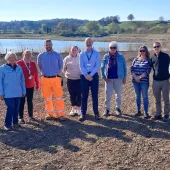
Alex Briggs, ecology lead at Geodime Ltd, sheds light on a sand martin habitat case study at Holme Sand and Ballast LLP’s Masters Quarry in Dorset
Within a quarry in Dorset, sand martins (Riparia riparia) arrive in early summer to nest in the steep sandy cliffs, swooping to catch insects as heavy plant works below. Sand martins are gregarious, forming colonies of burrows in cliff faces, often on river cliffs created by meanders. Quarrying creates similar cliff landforms, and sand quarries are important sand martin habitats. Amid the gloomy daily news updates on the COVID-19 pandemic, good news has come from unexpected angles, such as wildlife benefiting from reduced human activities. As the global biodiversity crisis continues, the question of how humanity can sustainably coexist with wildlife will be posed in every aspect of our lives and industries.
The use of remote sensing has become increasingly commonplace and is in the process of revolutionizing industries such as quarrying and construction as well as the ecology sector, to name but a few. Within quarries, imagery taken by remote sensing can be used to create accurate 3D models for measurement, analytics and design purposes. Within the ecology sector, habitat mapping for many species using remote sensing has become highly accurate and standardized. These applications have been made possible largely by the emergence of drone technology. Once a quarry has been flown for survey purposes, the imagery and digital elevation models can be used for habitat mapping with little adaptation.
The imagery taken during drone flights is used in the same way as satellite imagery, however, conducting drone surveys provides imagery to a far higher degree of accuracy and resolution. For example, Google Earth uses satellite imagery from the Landsat satellite constellation, with a resolution of 30m per pixel. In contrast, drone imagery can produce a similar aerial map, but with a resolution of a few centimetres or less, to produce highly accurate maps and models. Applications of such advances for the quarrying sector are manifold. The ability to identify potential habitat areas for protected species can allow quarry managers to reduce conflict between wildlife and quarrying activity.
Sand martin nests are protected in the UK by the Wildlife and Countryside Act (1981). However, they are vulnerable to human activities in quarry environments, being known to nest particularly in steep, bare sand faces. This nesting behaviour can cause disturbance in the lives of both the birds and quarry managers, disrupting works and potentially sterilizing working areas until the end of the breeding season. Conservation bodies the world over, including the Royal Society for the Protection of Birds (RSPB) in the UK, have produced guidance documents for quarry managers to prevent disturbance to sand martins and reduce conflict between stakeholders. However, these documents often overlook the benefits of emerging remote-sensing technology as a tool to aid management.
To demonstrate this, and to create a simple GIS (Geographic Information System) case study, Geodime Ltd took an orthorectified photograph and a digital elevation model for Masters Quarry, in Dorset, operated by Holme Sand and Ballast LLP. These data were provided by surveyors updating the topographical survey of the quarry and could easily be used to identify areas where sand martin colonies may occur. A GIS model was created using the software ArcGIS 10.4.1 and knowledge of the habitat preferences of the target species, which are steep cliff faces more than 2m high on bare, vegetation-free, exposed sand.
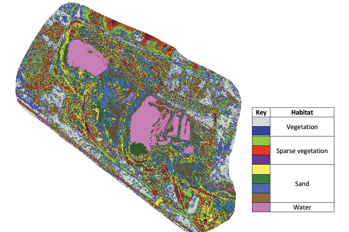
A model was used to identify areas where these habitat preferences are met and where optimal conditions overlap. For example, to identify bare, sandy soil, a process known as an unsupervised classification was carried out, splitting the orthorectified photograph into 10 categories grouped by pixel colour (fig. 1). These categories were assigned a number to signify habitat value (higher numbers signify higher habitat value (fig. 2)). This process can be carried out for many habitat factors, such as geology, proximity to water and slope (fig. 3).
These restriction layers were then combined to produce a raster model showing where optimal habitat factors overlap. Suitable sand martin habitat identified by the model is highlighted in red pixels. The final habitat suitability model identified four areas of clustered red pixels showing optimal habitat where colonies may occur (fig. 4). In the past, this process has proved difficult, as other sources of data, such as aerial surveys from planes or satellite images, are expensive and/or of low spatial resolution. The current method has identified multiple areas of potential habitat, including areas where sand martin colonies have already been observed (fig. 4, cluster A).
Geodime are working to develop this study by including the use of ground surveys to confirm the presence or absence of sand martin colonies and to promote the use of remote sensing for mapping habitat suitability. As drone mapping becomes ubiquitous and of ever higher quality, there will be increasing applications for ecology. Models such as these may improve the efficiency of ecological ground surveys, prevent the accidental destruction of colony sites, or, conversely, identify areas suitable for habitat creation, and ultimately be used to reduce human–wildlife conflicts.
There is no simple solution to allow humans to coexist with wildlife in a sustainable manner, but advances in technology will inevitably supply part of the answer. As remote-sensing technology develops further and imagery improves, the uses of GIS for more complex identification and classification of flora and fauna are likely to increase exponentially. This is a rapidly emerging area of ecological research, with articles on new applications being published regularly, and is likely to result in benefits to both industry and biodiversity in the quarry environment.
Acknowledgement
With thanks to Holme Sand and Ballast LLP for allowing the use of their data.
- Subscribe to Quarry Management, the monthly journal for the mineral products industry, to read articles before they appear on Agg-Net.com