It’s Official: Quarrying Adds To Biodiversity
GIS study at Cefn Mawr Quarry demonstrates the added value of rock extraction to nature
By Gerry Lucas, Edge Hill University; Pauline Michell, Michell Ecology; and Noel Williams (retired), Hanson Cement (formerly Castle Cement)
During 2008, west Lancashire-based Edge Hill University was commissioned by HeidelbergCement to carry out a large-scale biodiversity study of Cefn Mawr Quarry and its environs, near Mold, in North Wales. Cefn Mawr, at that time operated by Castle Cement, was producing approximately 700,000 tonnes per annum of Carboniferous limestone for the nearby Padeswood cement works. The university had already carried out a study of an effective slope restoration project pioneered by the then quarry manager, Noel Williams, and his quarry-based team of workers.
The aim of the biodiversity study was to measure and inform the development and production of a set of indicators to guide the sustainable operations of the quarry, while at the same time protecting any ecological and landscape interests the site possessed.
What had been suspected, and became apparent as the study concluded, was that the slope restoration methods extant over the previous 15 years had had a significant impact upon the development of biodiversity. One of the most important techniques used during the study was the development of a geographical information system (GIS) to map and quantify the biodiversity. This method produced some revealing maps and an even a more dramatic conclusion.
Cefn Mawr Quarry, its operation and restoration added very significantly to the local biodiversity rather than damaging or destroying it, as is often the received wisdom. This work carries an important message for quarry managers, planners and restoration and ecology professionals alike.
The site
Cefn Mawr Quarry is located to the west of Mold in an area with many landscape and ecological designations. To the west of the quarry lies the Clwydian mountain range, an Area of Outstanding Natural Beauty (AONB). Part of the quarry site falls within the Alyn Valley Woods and Alyn Gorge Caves SSSI/SAC. Prior to quarrying at Cefn Mawr, which probably began more than a century ago, the site and surrounding land was predominantly sheep-grazed upland pasture with localized small-scale lead and zinc mining taking place in shallow bell pit mines.
The current site probably commenced operations in the late 1940s. The resource is won from the economically important Carboniferous limestones of the Cefn Mawr and Loggerheads formations, which provide the feedstock for more than 10 current or recent hard rock quarries in the Clwydian mountain range.
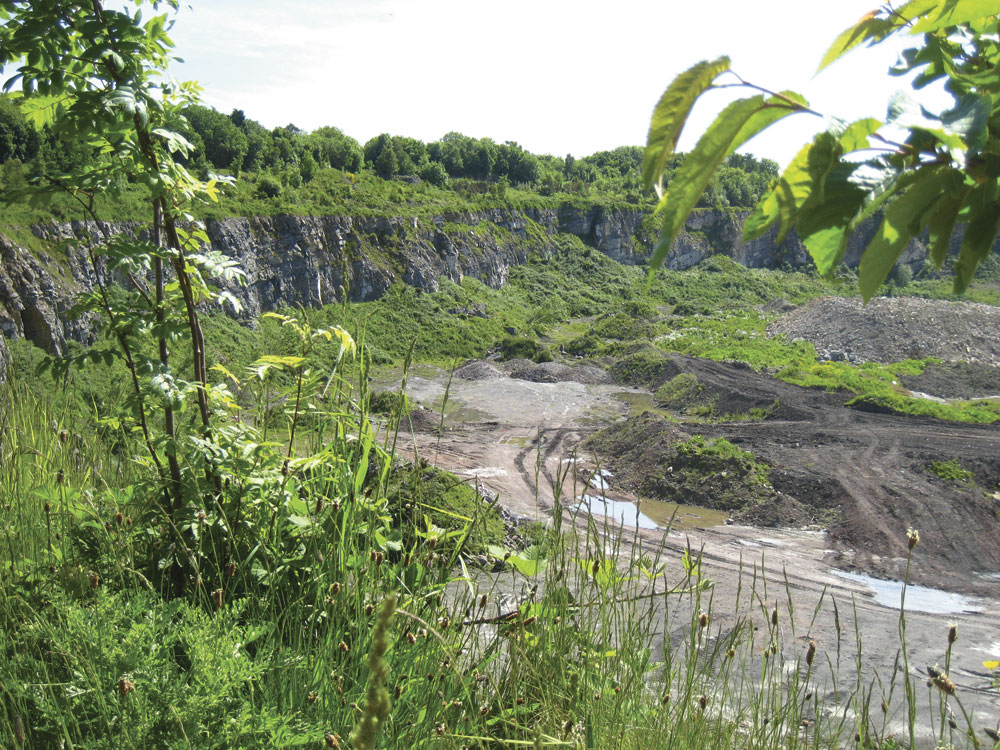
A cursory view of the area in Google Earth’s 3D mode (fig. 1) illustrates the visual impact that quarrying has had on the area. But one of the motivations behind the study was to measure the degree of impact on the biodiversity rather than the visual impact, which is so often a measure of the disturbance of rock extraction.
The slope restoration project
Originally intended as a quarry-based operation to mitigate the visual impact of the site on a hilltop in a landscape-sensitive zone, the methodology developed by the quarry manager, Noel Williams, was fashioned to provide a cost-effective mode of operation as a well as to address site concerns for conserving the nature content. Favoured by a relatively thick glacial drift soil (in excess of 1m) overlying the hard rock resource, and with a vegetation substrate of ash-hawthorn woodland or calcareous grassland, the restoration method involved restoration blasting and a somewhat piecemeal and apparently crude method of habitat translocation involving bund-bound temporary nurseries and slope mantling with soils and vegetation.
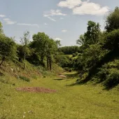
Such a process provides immediate visual mitigation and takes with it the floristic and animal species bank. Measurements show that around 80% of the trees survive, including mature individuals. Despite this ‘low-tech’ mode of operation, these techniques seem to have been very successful at Cefn Mawr (see fig. 2) and preliminary habitat surveys conducted in 2006 confirmed this in terms of the number of floral species present on the restored slopes, with in excess of 40 species present after one year and around 65 species present and stable after 4–15 years.
As part of this initial study, an attempt was made to cost this internally orchestrated restoration operation. Although acknowledging the limitations of a calculation based on unaudited documentation and survey, it appeared that this in-house operation was somewhere between 10 and 17 times cheaper than contractor-based engineering. This seemed far beyond any significant margin of error and did not take into account any added value that was measured later on in the biodiversity study.
The in-house slope restoration pioneered by Noel Williams proceeded as shown in figures 3–7.
The biodiversity study
HeidelbergCement, as a corporate group, have a strong commitment to sustainable operations and biodiversity in particular1,2. The study was commissioned to inform the development and production of a set of ‘biodiversity indicators’ to direct the sustainable operations of the quarry, while at the same time protecting the ecology and landscape of the quarry and its estate.
The project took place over a six-month period during the spring and summer of 2008 and involved a desktop study followed by continuous field surveys, which included flora, bird, butterfly, dragonfly and other protected-species surveys, as well as an assessment of the water bodies present. The main biological survey was the Phase 1 habitat survey3. The JNCC (Joint Nature Conservation Committee) has produced a standardized and relatively rapid system to record semi-natural vegetation and other wildlife habitats. Each habitat type/feature is defined by way of a brief description and is allocated a specific name, an alpha-numeric code and unique mapping colour. At the simplest level of interpretation, the more Phase 1 habitats recorded, the more biodiverse in plants and animals the site is likely to be. Data were collected using a GPS-enabled data tablet. The survey technique lends itself to the production of GIS-based maps and associated databases. In addition, any habitats not categorized by the Phase 1 method were also surveyed, categorized and described as ‘partial living spaces’ and included in the database.
To allow a comparison of the site and the impact upon the biodiversity, three survey zones were identified: operational (quarry and plant); restored; and a 500m wide buffer, which effectively encompassed the surrounding countryside (fig. 8).
The collated data were presented as a GIS, using ESRI’s ArcGIS, and the database interrogated to provide a numerical analysis of the levels of floral diversity found within the different survey zones.
Results of the biodiversity study
In excess of 300 species of flora were identified at the site. More species of flora per hectare were found together in the operational and restoration zones of the quarry than in the buffer zone, showing that a continuous cycle of disturbance was a key factor in increasing the levels of biodiversity within the quarry.
Statutorily protected species were found at the site and some of the species and habitats are listed in the UK and/or Flintshire Biodiversity Action Plans4. Nationally scarce species were also present.
Wildlife was found to be thriving in the most disturbed parts of the quarry, with evidence of a range of species found in the operational zone. In total, 338 different floral species were identified on site. One of the most surprising biodiversity indicators involved the use of the database to compare the density of floral species in the different zones (see table 1).
The quarry floor, heavy plant areas and access roads (operational zone) had an indicator of 4.4 floral species per hectare – effectively a third more than the surrounding countryside (buffer zone). The restoration zone had 27.8 floral species per hectare – nine times more than the buffer zone. In turn, it can be predicted that with so much floral diversity, there will be a corresponding increase in small and large animal life using the habitat. A measure of the biodiversity and its complexity is shown in figure 9, which illustrates the 31 habitats that exist in the area, 28 of which are in the operational and restoration zones and are effectively the consequence of the limestone extraction and production process. The biodiversity of the restored zone is likely to be even greater as it contains a significant amount of inaccessible habitat, such as rock faces, slopes, ledges etc, which could increase its biodiversity value if investigated further. It is known, for example, that birds such as the peregrine falcon use the rock ledges for nesting. It is considered that the floristic diversity is a consequence of the sensitive restoration process and then, effectively, abandonment and minimal management.
Partial living spaces (PLS)
One of the most engaging developments of the survey was the identification of ‘partial living spaces’, which added so much to the biodiversity indicators. Partial living spaces are temporally and/or spatially restricted habitats that exist in quarries. They result from the normal everyday working practices and/or from sensitive restoration or abandonment practices. Partial living spaces exist for short or medium periods of times (days, months or even decades in some instances). They are often isolated in location and sometimes relatively small in size (c.2m2). Examples include soil piles, stockpiles, wheel ruts, roadways, abandoned equipment, buildings, faces, benches, joints, bedding planes etc. They have often been overlooked as potential sites for biodiversity in quarries and their environs but can provide important colonization sites and refuges for plant and animal species, albeit in somewhat restricted circumstances. For example, in the JNCC classification these sites are designated I: Exposure or J: Miscellaneous. This is too coarse a classification and does not assess the habitat potential or possible biodiversity value of these sites. Typical partial living spaces are shown in figures 10 and 11. In total, 19 partial living spaces were identified at Cefn Mawr and given unique codes in the site’s extended JNCC Phase 1 classification. Their inclusion in the database significantly added to the biodiversity counts.
Conclusion
The study has shown that quarrying operations need not be a limiting factor on the presence of biodiversity, and that, ironically, the resultant landscape can provide a range of opportunities for wildlife, even within the most active parts. Successful management of biodiversity interests can be achieved in conjunction with normal operations. Cefn Mawr Quarry adds rather than takes away biodiversity, to the tune of nine times that of the surrounding area. Sensitive restoration techniques of the type pioneered on site and appropriate conservation of partial living spaces can add significantly to the biodiversity indicators. The quarrying industry and associated professionals should take note.
For further information, contact author Gerry Lucas via email: Lucasg@edgehill.ac.uk
References
- http://www.heidelbergcement.com/global/en/company/sustainability/index.htm
- TRÄNKLE, U., RADEMACHER, M., FRIEDEL, G., LÖCKENER, R., and V. SCHMID: ‘Sustainable Development Indicators for Integrated Raw Material and Nature Conservation Management’, Cement International, vol. 6, April 2008.
- http://jncc.defra.gov.uk/page-2468
- Flintshire Local Biodiversity Action Plan – Creating Space for Wildlife.