Bytham River Aggregates
by James Rose, Department of Geology, Royal Holloway University of London
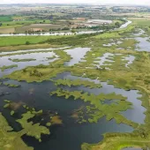
The Bytham river was the largest river in England until its valley was overridden by the ice sheets of the Anglian glaciation about 450,000 years ago. This river catchment extended from the West Midlands and southern Pennines, through the region of Coventry, Leicester and Melton Mowbray, to East Anglia, where the main channel was located along a line from around Mildenhall, Diss and Lowestoft into the area that is now the North Sea. For much of this time land covered the area of the southern North Sea and the Bytham river continued eastward to join the river Thames and river Rhine, before heading northwards to the contemporary coastline (fig. 1).
When glaciers overrode the Bytham river they buried the valley beneath glacial deposits (till, sand and gravel) in the area around Stratford-upon-Avon, Coventry and Leicester; eroded the deposit but left fragments behind north of Leicester and what is now the lower Soar and Wreake valleys; and buried the deposits in a deep gorge between Melton Mowbray and the Fen Basin. The Wash and Fen Basin were eroded and formed by this ice sheet and all the Bytham river deposits have been removed from this area. East of the Fen Basin, the glaciers again eroded but left fragments of Bytham river deposits between King’s Lynn and Mildenhall. Eastward of Mildenhall to the sea, the Bytham river deposits are mainly buried beneath varying thicknesses of till, although locally they have been extensively eroded by glacial melt water.
The typical Bytham river aggregate is distinctive red sand, or a very durable quartzite-rich sand and gravel, and both deposits are a ‘clean’ product with minimal clay. The composition and condition of these deposits can be explained by the fact that the Bytham river eroded and transported the Sherwood Sandstone and Kidderminster Conglomerate (formerly known as the Bunter Pebble Beds) of the Trias from the West Midlands along its channel to the North Sea. Within particular regions there may be a component of other materials, eroded from the local bedrock of the area. In the region of south Lincolnshire, for instance, there is an addition of Jurassic limestone and ironstone, and further east flint derived from chalk bedrock or marine sands and gravels is mixed with the quartzites. The ‘cleanness’ of the aggregate is due to burial beneath the glacial deposits, and protection from soil-forming processes that cause the production of clay. Locally there are discontinuous beds of silt and clay and organic material that represent former fine-grained flood plain sediments.
Typical examples of Bytham river aggregate quarries can be found now, or in the recent past, at Snitterfield near Stratford-upon-Avon, Wolston and Waverley Wood near Coventry, Huncote near Leicester, Brookesby between Leicester and Melton Mowbray, and Castle Bytham and Witham on the Hill in south Lincolnshire. East of the Fen Basin quarries exist or have recently existed at Feltwell near Brandon, Timworth and Ingham north of Bury, Knettishall near Diss, Kirby Cane near Beccles, and Norton Subcourse near Great Yarmouth. The quarries west of the Fen Basin work red sand and quartzite-rich gravels; those east of the Fen Basin mainly work quartzite-rich gravels with a large component of flint.
The discovery of the Bytham river arose from the extraction of sand and gravel by Bullimores Sand and Gravel Ltd at Witham on the Hill in south Lincolnshire. In the 1980s the late Roger Bullimore realized that the company was running out of red building sand (their main product at the time) and contacted the author to see if he could help find a new resource. The author was keen to do this because he was interested in the glaciation of the area and expected the material to be a glacial meltwater deposit. On visiting the quarry at Witham on the Hill, however, it was apparent that the sands and gravels had nothing to do with glaciation, nor with the bedrock geology of the local area. The sands and gravels were the type of material found in the West Midlands and studies of the structures indicated that they were transported by a large, eastward-flowing braided river.
After investigating published literature on the geology of the areas to the east and west it was found that to the west a similar deposit had been described as the Baginton-Lillington sands and gravels1, and to the east a similar deposit was known as the Ingham sands and gravels2. Having travelled across the country checking out borehole records, old and active sand and gravel pits and doing field mapping, it was clear that this was a single geological unit, formed by a very large river that flowed from the west to the east. With this information, and focused borehole surveys, it was possible to predict the location of new resources of aggregates for Bullimores, firstly as an extension of the quarry at Witham on the Hill, and then as a new quarry at Red Barn, Castle Bytham. Earlier this year Red Barn Quarry received planning permission for an extension.
This investigation for an aggregate resource has had major implications for our understanding of the recent geological history of Britain and our understanding of the timing of the first humans in northern Europe. Furthermore, the implications have considerable importance for the implementation of planning regulation with regard to archaeology and the aggregates industry.
Geological importance
The recognition of the sands and gravels at Witham on the Hill as part of a river that extended across the country was new. Previously the deposits to the west were thought to have been formed by glacial meltwater1, and the deposits to the east were attributed to the Ingham river, but the catchment was confined to East Anglia2. The interpretation now accepted was published in 19873 and caused considerable antagonism, some of which remains, as it showed that the so-called glacial meltwater deposits are pre-glacial, leading to a revision of the glacial history of Britain. In 1994 the river that formed these sediments was named the Bytham river and the deposits are known as Bytham sands and gravels4. This is appropriate, not only because of the location in which their origin was discovered, but also because it is the area worked by Bullimores Sand and Gravel who have supported research into this topic over a period of nearly 30 years.
Archaeological importance
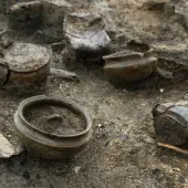
It was apparent from further reading during the early stages of investigating the Bytham sands and gravels that the deposits are associated with archaeology in the form of hand axes5. This was confirmed by excavations at High Lodge near Mildenhall in 19916 and at a Tarmac quarry near Bury St Edmunds4. Since then a major project on the origins of the earliest humans in Britain (AHOB), funded by the Leverhulme Trust to the sum of £2.2 million, has shown that Bytham river sites hold critical records of the earliest humans in northern Europe, and the coastal site at Pakefield near Lowestoft has shown that people were in Britain at least 700,000 years ago, some 200,000 years earlier than previously believed7. The Bytham river appears to be a major route along which the earliest humans moved across Britain and the evidence of these people is preserved, like the aggregate resources, below the glacial deposits. The Bytham river sediments could perhaps be considered the most important archaeological site for the understanding of early human occupation in the whole of northern Europe.
Planning regulations — archaeology and the aggregate industry
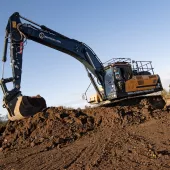
Current planning policy appears to adopt a restrictive approach to aggregate extract-ion with archaeology seen as a constraint on the approval of consent for extraction. As is clearly seen from the work on the Bytham river aggregate resource, science and archaeology would not have progressed without mineral extraction. Furthermore, the type of archaeology being recorded is of fundamental importance to our whole understanding of human origins, and ‘not just another heap of Roman slag’ or yet one more ‘indeterminate ditch’. Clearly a prima facie case exists for this type of archaeology to be used as a case to support planning approval in order to enhance the chance of finding more critical evidence about our earliest ancestors in northern Europe.
References
- SHOTTON, F.W.: ‘The Pleistocene deposits of the area between Coventry, Rugby and Leamington, and their bearing upon the topographic development of the Midlands’, Philosophical Transactions of the Royal Society, 1953, London, B237, pp209–260.
- CLARKE, M.R., and C.A. AUTON: ‘The Pleistocene depositional history of the Norfolk-Suffolk borderlands, Institute of Geological Sciences Report, 1982, no. 82, pp23–9.
- ROSE, J.: ‘The status of the Wolstonian glaciation in the British Quaternary’, Quaternary Newsletter, 1987, no. 53, pp1–9.
- ROSE, J., and J.J. WYMER: ‘Record of a struck flake and the lithological composition of ‘pre-glacial’ river deposits at Hengrave, Suffolk, UK’, Proceedings of the Suffolk Institute of Archaeology and History, 1994, no. 38, pp119–125.
- WYMER, J.J.: ‘The Palaeolithic sites of East Anglia’, 1985, Geo. Abstracts: Norwich.
- ASHTON, N.M., COOK, J., LEWIS, S.G., and J. ROSE: ‘High Lodge: Excavations by G. de Sieveking, 1962-8, and J. Cook, 1988,’ 1992, British Museum Press: London, pp192.
- PARFITT, S.A., BARENDREGT, R.W., BREDA, M., CANDY, I., COLLINS, M.J., COOPE, G. R., DURBRIDGE, P., FIELD, M.H., LEE, J.R., LISTER, A.M., MUTCH, R., PENKMAN, K.E.H., PREECE, R.C., ROSE, J., STRINGER, C.B., SYMMONS, R., WHITTAKER, J.E., WYMER, J.J., and A.J. STUART: ‘The earliest record of human activity in Northern Europe’, Nature, 2005, no. 438, pp1008–1012.