The Use of Drones in Plant Engineering
First published in the October 2019 issue of Quarry Management as An Important Business Tool
BEUMER Group experts Eugen Doberstein and Lukas Paul discuss the potential benefits of using unmanned aerial vehicles in plant engineering applications
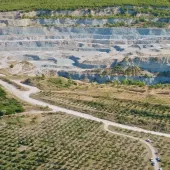
The use remote-controlled drones over building sites or quarries may once have sounded futuristic – but not any longer. Equipped with cameras, unmanned aerial vehicles (drones) are becoming part of everyday business for the planning, execution and documentation of construction projects, particularly those involving difficult-to-access areas or, for example, belt conveyors systems that extend over several kilometres.
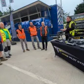
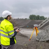
‘We have been working with drone technology for about three years now. In this industry, drones have become standard equipment – whether it is for measuring construction sites or for operating and maintaining facilities,’ said Eugen Doberstein, project engineer for overland conveyors with German material handling equipment specialists BEUMER Group. ‘One of the main reasons for the increased use is higher standards in occupational safety: only a few (or even no) people are on site and exposed to potential hazards. In general, the use of aerial vehicles is becoming increasingly important for many companies in very different industries. We are mainly using them in the area of plant engineering.’
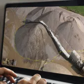
Lukas Paul, pipe conveyor specialist and manager of plant design/bulk material handling systems (sales) at BEUMER Group, said: ‘If, for example, customers authorize us to supply and install a belt conveyor, we have to submit a detailed quotation beforehand. Here, it is important to assess the project correctly. We usually do not have a lot of time to do this, but the use of aerial photographs that are analysed by specialized software provides an effective way to accomplish this. This has made drones an important tool for us. They are equipped with high-performance cameras that provide image data we can use to create reliable plans.
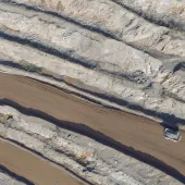
Mr Paul continued: ‘We have, for example, planned and supplied a belt conveyor in Indonesia that transports material from a quarry to a cement plant. The route led through the rainforest and was very demanding from a topographical point of view. By means of the drone, we were able to work out and compare different routings. In particular, the very long corridor along which the conveyor would eventually run required complex project planning. Using drone photographs allowed us to recognize, for example, whether the terrain was sloping or whether there were buildings, waterways or other obstacles in the way. This allowed us to adapt the routing of the system in an optimum way. If these obstacles are identified at a later stage, the construction of a conveyor becomes much more complex. Depending on the size of a project, later on we may even control the complete construction process by means of the drones.’
‘In the past, before drone technology arrived, a survey team would generally have been sent out during the planning phase, but this was time-consuming and expensive – and often at the stage where it was not yet clear whether the customer would realize the project at all,’ said Mr Doberstein. ‘Later, Google Earth provided an alternative. Its software superimposes satellite and aerial images of different resolutions with geodata and shows this on a digital elevation model of the Earth. However, this data is not as accurate and up to date as the recordings of a drone, which, for example, can detect whether a new building has been erected or traffic routes have shifted within a mine or quarry.’
‘Customers benefit from the use of drones because they save considerable time and cost,’ added Mr Paul. ‘If the customer is not yet sure whether they will proceed with a project, we can quickly provide them with precise and low-cost data during the project pre-planning phase by means of drone recordings and our further calculations. On this basis, the customer can make the decision: Is the project worth it or not? But we also benefit from significantly less effort, ie manpower, amongst other things, and this is reflected in the costs. Drones are presenting an excellent solution to get a first overview.’
Commenting on how drone systems have developed, Mr Doberstein said the technology had become much more mature over the years: ‘Nowadays, drones are smaller and their quality improved. In addition, the cameras being used are becoming more compact and are delivering increasingly high-quality images. The stabilization systems have been improved, too. Aerial vehicles are now able to connect to certain satellites and thus access GPS data to maintain their position. Even strong gusts of wind can no longer drive them away. Controlling a drone is quite simple today, but of course, users have to acquire a certain know-how. They can also plan the route on a computer, using appropriate software to calculate the exact flight path. The drone then flies its pre-determined route.’
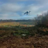
Two different drone designs are available – the copter and the fixed-wing aircraft, but what are their respective advantages and for which applications is each version most suitable? ‘With regard to functionality and characteristics, the copters are similar to helicopters,’ said Mr Paul. ‘With their rotors, they can stand still in the air like their big brothers. Fixed-wing aircraft, on the other hand, are more comparable to aeroplanes. They also have a greater range. As soon as they are in use, they are constantly in motion.
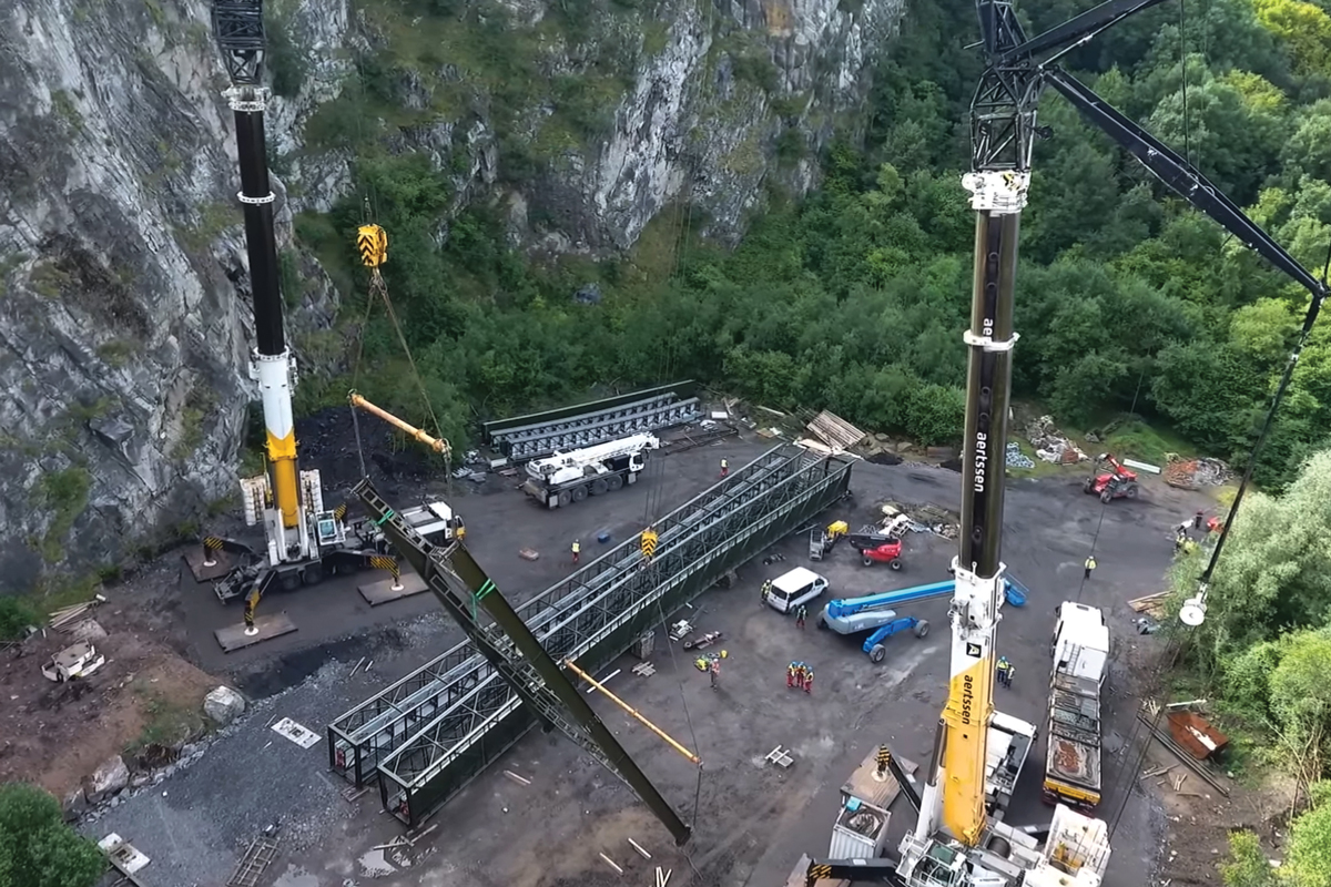
‘Copters are, therefore, particularly suitable for narrow take-off and landing areas, or when they have to perform at low speed. Operators can control them manually and they are mainly used to fly over small and medium-sized construction sites. They are also useful for the inspection of quarry faces or the lower sides of bridges etc. Due to the fact that we only need to measure one corridor for a belt conveyor, we use a copter for our projects. If the route extends over several kilometres, we divide it into several segments, as the drone is only able to fly over the route in sections due to its limited flight time.’
Commenting on the legal and technical framework conditions that have to be considered when using drones, Mr Paul said: ‘In Germany, we have to consider the legal regulations of aviation law and the air-transport authorization regulations. In addition, there are copyright and data-protection laws as well as property and personal rights of third parties that can limit the use of camera-equipped drones. Abroad, however, this is not always clearly defined and can vary from country to country. It all starts with the question: Are we even allowed to transport the drone in a plane to its destination?’
- Subscribe to Quarry Management, the monthly journal for the mineral products industry, to read articles before they appear on Agg-Net.com