Scanning mines with SLAM technology
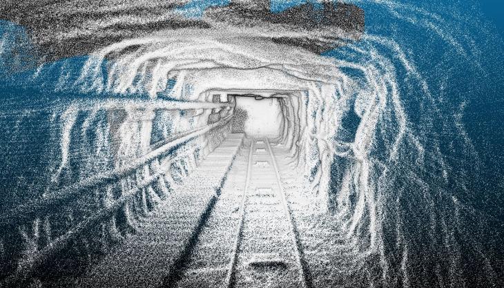
Laser scanning a mine highlights the accuracy, quality, and volume of data possible with this technology.
Using Simultaneous Light and Motion (SLAM) technology with a ZEB Revo handheld laser scanner, Geodime were able to survey 4km of underground mine in a single day. The amazingly high-resolution results impressed and Geodime were extremely excited by the accuracy that a SLAM scanner can achieve underground.
