Exxaro choose Riegl V1000
3D Laser Mapping’s long-range laser scanner supports South African coal mine expansion
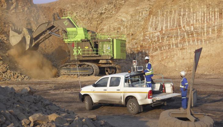
SOUTH African-based mining group Exxaro have purchased a long-range laser scanner to support a range of expansion projects and the building of two additional coal-processing plants.
The Riegl VZ 1000 purchased from Nottingham-based 3D Laser Mapping will be used to survey stockpiles for volume verification, provide height analysis on earthworks and blasting, as well as collecting highly accurate measurements for terrain mapping and modelling, all while minimizing staff exposure to health and safety risks within the mine.
‘I was given the task of looking at cost-effective solutions that would allow us to cope with the increase in workload resulting from current and future expansion projects, without the need for additional surveyors,’ commented Thys Smith, chief surveyor at the Grootegeluk coal mine.
‘The obvious solution was laser scanning. Critical factors in my choice of scanner were safety, accuracy, speed of operation and confidence in the resulting data. The VZ 1000 will also allow us manage risk, minimizing surveyor contact with moving equipment and potential fall of grounds, and reducing the need to work at height.’
The VZ 1000 is a high-speed laser scanner with a wide range of view. The VZ 1000 utilizes unique echo digitization and online waveform analysis to achieve superior performance and accuracy of measurement, even under adverse weather conditions. Achieving accuracies of 5mm at ranges of up to 1,400m, the VZ 1000 can measure up to 122,000 points per second with a 100 x 360-degree field of view.
The VZ 1000 will initially be used at the Grootegeluk Mine in the Waterberg area of the Limpopo Province of South Africa. An open-pit mine employing approximately 2,000 people, Grootegeluk produces 18.8 million tonnes per annum of final coal products using conventional truck and shovel operations.
The mine covers a surface area in excess of 17,500ha with a mining rights area of approximately 6,500ha and a current pit size of 820ha. Current expansion projects include the Grootegeluk Medupi Expansion Project and future plans consist of the Exxaro Thabametsi Mine project, which includes the building of two additional plants.
‘To cover a mine the size and complexity of Grootegeluk calls for a team of expert surveyors supported by the latest technology,’ said Mr Smith. ‘The work we do includes bench surveying, volume verification, height analysis, as built surveys, terrain mapping and modelling, and ground control and contouring.
‘The VZ 1000 gives us the necessary range and distance on the coal face combined with the accuracy of data we require. The results can be integrated with our current software and solutions already in place in other areas of the business.’
