Combining sensors and remote vehicle platforms
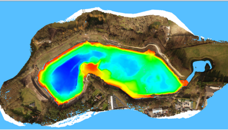
The 3D model (pictured) shows the possibilities of combining multiple remote sensing techniques, using multiple sensors and multiple types of unmanned autonomous vehicles, to conduct a survey.
A recent challenge was monitoring the erosion of sand faces beside a lake requiring elevations above and below the water line. Combining hydrographic bathymetry with topography is not a straightforward task, but by combining a range of cutting-edge technology Geodime can create models to visualise sites.
The company used a combination of multiple sensors and remotely operated vehicles. They mounted a camera on a UAV, and SONAR on a remotely piloted boat, to provide a detailed 3D model and depict a complex landscape.
Geodime had the unusual opportunity to watch one unmanned vehicle collecting data through the lens of a second as they simultaneously surveyed the same area. Using these cutting-edge technologies and techniques in harmony highlights the exciting potential of what the modern surveyor can accomplish and what may be accomplished in the future.
