BGS Civils: Mapping the earth you move
British Geological Survey launches new datasets for informing ground engineering works
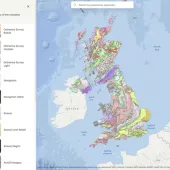
THE British Geological Survey (BGS) has launched new datasets for informing ground engineering design called ‘BGS Civils’. The package includes a suite of seven engineering properties for soils and rocks nationwide including strength, bulking volumes and corrosivity, and has been developed to facilitate desk study screening for ground engineering projects.
Properties of rocks are important in all engineering projects and the new maps provided by BGS Civils will, for the first time, deliver this information efficiently to those undertaking desk studies. The information will allow the planning of focused specific site design and will inform engineering geologists and ground engineers at the desk study stage of investigation, allowing for more efficient planning and execution of ground investigations.
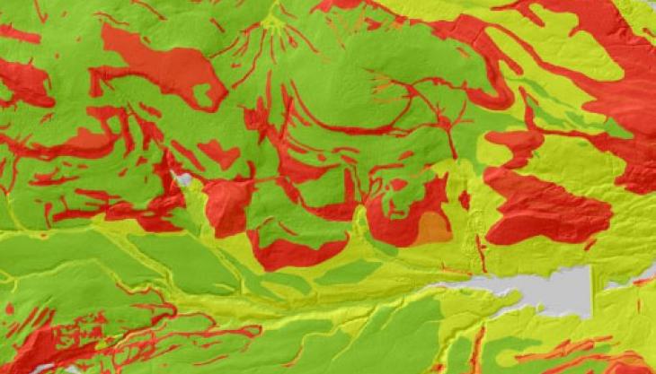
The seven engineering properties for soil and rocks included with in the BGS Civils dataset are:
- Excavatability – and information on suitable zones for excavation and the local factors controlling it
- Strength – of geological materials (rocks and fine soils)
- Discontinuities – or any break or change in the rock that could lead to a reduced strength
- Bulking – or the increase in volume when excavated from its in-situ location
- Sulfate and sulfide – potential in rocks that can give rise to aggressive ground conditions
- Corrosivity – or the potential for the slow destruction of a solid material by a chemical reaction
- Suitability of excavated geological material to be used as engineered fill.
Dr Kate Royse, director of environmental modelling and product development with the BGS, said: ‘Properties of earth materials are important for all engineering projects and the new BGS Civils data product provides a quick way of getting a generic assessment of the likely ground conditions at the pre-tender and desk study stage.
‘This should make tender preparation, planning and execution of ground investigations far more efficient and reduce project overspend. In addition, as Building Information Modelling (BIM) becomes the norm for all UK government procured projects, BGS Civils can be used in conjunction with BIM applications.’
The BGS Civils engineering property data is expected to be of interest to a wide range of organizations concerned with development, including utility companies, local authorities, developers and engineering consultants and contractors.