Maptek and senseFly in joint agreement

Maptek to supply senseFly’s mapping and inspection drones to aggregates and mining customers in North America
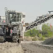
MAPTEK, specialists in precision measurement and visualization for the mining industry, have signed a new partnership agreement with Swiss drone manufacturers senseFly.
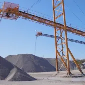
Under the terms of the agreement, Maptek will be providing North American customers in the mining and aggregates industries with senseFly’s professional mapping and inspection drones (eBee, eBee RTK and albris), alongside their own popular I-Site Studio 3D modelling software.
‘By combining a senseFly UAV with our I-Site Studio 3D modelling software, customers in the mining industry now have a powerful solution that is driven by survey requirements, as well as the in-depth modelling, change detection and data output requirements demanded by mining professionals,’ said Todd Packebush, Maptek director of I-Site sales & business development.
Jean-Christophe Zufferey, CEO of senseFly, commented: ‘Our durable, largely automated mapping drones are already employed by thousands of professionals around the world, who appreciate the productivity and safety boosting benefits of collecting geospatial data from the air.
‘By partnering with Maptek, we are joining forces with one of the industry’s most respected and recognized solution providers – a company that is perfectly positioned to help bring such benefits to even more mining professionals.’